SHERBURNE SOIL AND WATER CONSERVATION DISTRICT
  • Home
  • The District
    • Tree Sale >
      • Tree Sale Store
      • Tree Seedling Care
    • Contact Us
    • Staff
    • SWCD News
    • SWCD Events
    • Webinars
    • Employment Opportunities
    • FAQ's
  • SWCD Programs & Services
    • SWCD Services
    • Financial Assistance
    • Forestry Management >
      • March Pruner Calendar
      • Citizen Pruner Dispatch
      • Urban Forestry Program
      • Tree Survey
    • Water Management >
      • We Are Water MN
      • Aquatic Invasive Species (AIS) >
        • AIS Grant Program
      • Stormwater Program
      • Sherburne COLA
    • Rural Resource Management
    • Water Quality Monitoring
    • Wetland Delineation
    • MN Buffer Requirements
    • Prairie Planting Program >
      • Grams county Park HELP Grant
    • Backyard Conservation >
      • Lawns to Legumes
    • Education & Outreach >
      • Metro Area Envirothon
      • Webinars
      • Elk River Clean Up
      • Little Elk Lake Watershed
    • Well Sealing Program
  • Board of Supervisors
    • Minutes and Agendas
    • Meeting Schedule
    • Legislative Reporting
    • Elections
    • SWCD Partners >
      • MCD Yellow Pages
  • Completed Projects
    • Raingardens
    • Shoreline Buffers & Stormwater Management
    • Native Prairie Installation
    • Pasture & Manure Management
    • Miscellaneous Projects
  • 2021 AIS Meeting Presentations
  • Highlights Videos
  • AIS Presentations
  • video
  • Rain Gauge Readers
  • Appreciation Dinner
Sherburne SWCD has sent our Letters to landowners who appear to have compliance issues based on satellite imagery. The SWCD will work with landowners who request assistance in evaluating alternative practice options.

If you have received a letter or have questions about Buffer compliance, please contact our office at 763-220-3434.

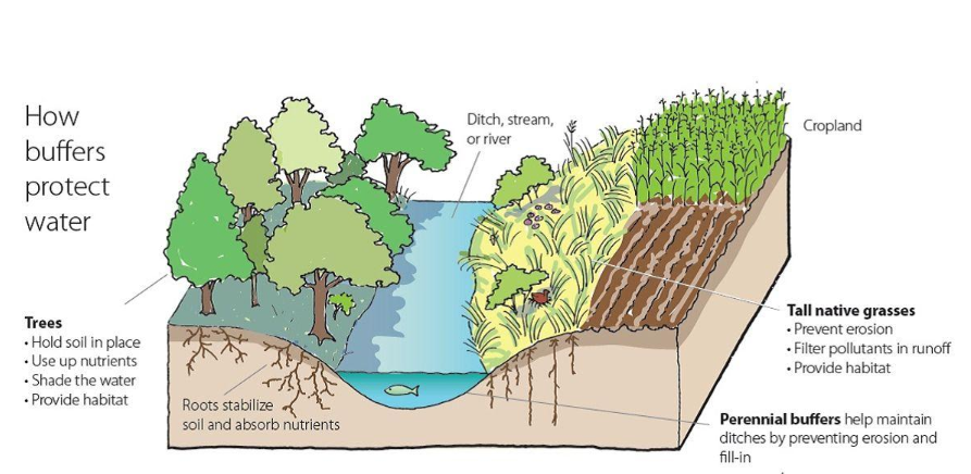
Minnesota Buffer Law

Requirements of the Buffer Law

     Public Waters
  • Require a 50-foot average width, 30-foot minimum width, continuous buffer of perennially rooted vegetation.
  • Buffers are measured from the top or crown of the bank.  Where there is no defined bank, measurement must be from the edge of the normal water level.

     Public Drainage Systems
  • Requires a minimum of 16.5 feet of buffer
  • Buffers are measured from the top or crown of the bank.  

SHERBURNE SWCD MONITORING PLAN
FOR BUFFER COMPLIANCE TRACKING

§103F.48 RIPARIAN PROTECTION AND WATER QUALITY PRACTICES
1.    COMPLIANCE TRACKING OF ALL PARCELS SUBJECT TO THE BUFFER LAW
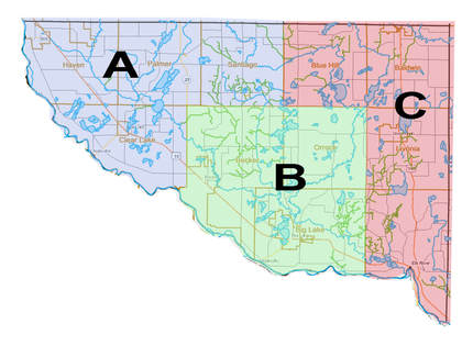
All parcels in the county are to be reviewed within a 3 year timeframe. Sherburne SWCD staff will review 1/3 of parcels each year. Tracking will include parcels affected by the public waters and public ditches. Staff will complete the review utilizing updated aerial imagery, site visits, or a combination of methods. Landowners will be notified prior to staff visiting the property.

2.    RANDOM SPOT CHECKS
Random spot checks will be done in addition to the tracking of all parcels within a 3 year span. These checks may be conducted via aerial photo review or on-site review depending on availability of updated aerial photos and access to the property.  A combination of both aerial and on-site review may also be used. The SWCD will conduct 5-10% of parcels on a random spot check review each year. Additionally, the SWCD will review parcels of emphasis more frequently.
•    Previously non-compliant
•    No-till/Conservation tillage or cover crop alternative practice plans
•    Variable width buffers (i.e. Land O’ Lakes buffer tool, Decision Support Tool)
•    Other Alternative Practice Plans
•    Cost-share funded projects (years 1,3,9 of contract)
•    Parcels of further emphasis (potential violators)

Picture
Click here for Monitoring Plan PDF

Quick Links
  • MN Buffer Law (BWSR)  
  • Check your Property for compliance

Picture
Sherburne Soil and Water Conservation District
Sherburneswcd.org     763-220-3434     425 Jackson Ave. NW     Elk River, MN 55330
Open Monday - Friday  8:00 - 4:00, by appointment       Closed on Federal Holidays

Sherburne Soil and Water Conservation Copyright © 2016
  • Home
  • The District
    • Tree Sale >
      • Tree Sale Store
      • Tree Seedling Care
    • Contact Us
    • Staff
    • SWCD News
    • SWCD Events
    • Webinars
    • Employment Opportunities
    • FAQ's
  • SWCD Programs & Services
    • SWCD Services
    • Financial Assistance
    • Forestry Management >
      • March Pruner Calendar
      • Citizen Pruner Dispatch
      • Urban Forestry Program
      • Tree Survey
    • Water Management >
      • We Are Water MN
      • Aquatic Invasive Species (AIS) >
        • AIS Grant Program
      • Stormwater Program
      • Sherburne COLA
    • Rural Resource Management
    • Water Quality Monitoring
    • Wetland Delineation
    • MN Buffer Requirements
    • Prairie Planting Program >
      • Grams county Park HELP Grant
    • Backyard Conservation >
      • Lawns to Legumes
    • Education & Outreach >
      • Metro Area Envirothon
      • Webinars
      • Elk River Clean Up
      • Little Elk Lake Watershed
    • Well Sealing Program
  • Board of Supervisors
    • Minutes and Agendas
    • Meeting Schedule
    • Legislative Reporting
    • Elections
    • SWCD Partners >
      • MCD Yellow Pages
  • Completed Projects
    • Raingardens
    • Shoreline Buffers & Stormwater Management
    • Native Prairie Installation
    • Pasture & Manure Management
    • Miscellaneous Projects
  • 2021 AIS Meeting Presentations
  • Highlights Videos
  • AIS Presentations
  • video
  • Rain Gauge Readers
  • Appreciation Dinner