
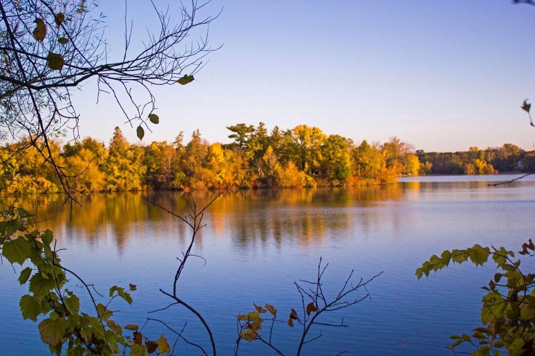
Water Management
Sherburne County has 493 miles of streams, 125 lakes and over 53,000 acres of wetlands. These water resources are used for fish and wildlife habitat, irrigation, drinking water, industry, and recreation. Each use listed can be affected by how clean the water is. The SWCD works with local, state and federal agencies as well as residents on a variety of programs in an effort to protect health of all waters within Sherburne County.
|
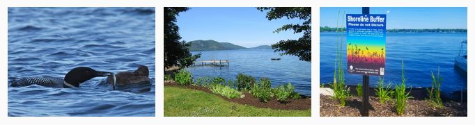
Shoreline Management
Your shoreline is part of a large community which can have impacts far and wide. Maintaining or restoring your shoreline is essential for our waters health and to providing fish and wildlife habitat. This concept, often referred to as shoreland buffers or lakescaping, extends both lakeward and landward from the water's edge. Generally, a natural buffer strip at least 25 feet landward is preferred, but any unmowed or undisturbed area provides benefits. Sherburne SWCD can assist you with technical information, design, cost share, and implementation of your project. To view more information on the SWCD Buffer program, Click Here. If you are interested in a shoreline erosion control project, please contact: Frances Gerde at 763-220-3434 x 104.
Aquatic Invasive Species
Invasive species are species that are not native to an area and cause economic or environmental harm or harm to human health. Invasive species can occur on land or in the water. Sherburne County's natural resources are threatened by a number of invasive species such as Zebra Mussels, Eurasian Watermilfoil, and Starry Stonewort. The Sherburne SWCD is working to prevent the spread and promote the management of invasive species.
The SWCD, via a resolution with Sherburne County, is working with a Local Task Force to develop an Aquatic Invasive Species (AIS) Prevention Plan specific to Sherburne County. Upon approval by the Sherburne County Board, the SWCD will work to actively implement the plan. Find out more here 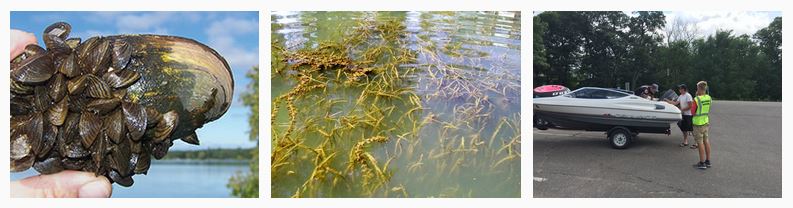
SHerburne County water plan
The Sherburne County Water Plan lists existing and potential opportunities to make sure that surface an groundwater are protected; it also develops a plan of action to resolve important issues like those identified here. Ultimately, the plan is the basis for obtaining funds to keep our water healthy for future generations! The Sherburne County Board of Commissioners adopted a resolution on July 7th, 2015 requiring the update and revision of the Sherburne Local Water Management Plan as authorized under Minnesota Statutes, Chapter 103B.301, the Comprehensive Local Water Management Act. The Sherburne SWCD is in charge of the revision and implementation of the Sherburne County Water Plan. As the State of Minnesota transitions towards watershed-based planning, the SWCD and County work hand-in-hand with neighboring counties to address water resource priorities on a watershed scale to maximize the effectiveness of water planning efforts (see One Watershed, One Plan below). Watershed restoration and protection strategy
The Watershed Restoration and Protection Strategy is a coordinated effort between 7 counties to protect and restore water quality in the Mississippi River. In 2009, Sherburne SWCD began leading the WRAPS (Watershed Restoration and Protection Strategy) to protect and improve the nearly three-quarters of a million acre Mississippi River (St. Cloud) Watershed. The key products of the WRAPS process, which were completed in 2014, include Total Maximum Daily Loads (TMDLs) for 12 lakes and 3 streams and a “road map” or implementation plan that documents how to protect good water quality where it exists and restore it in places where it is poor. These reports are available on the Minnesota Pollution Control Agency Website. As the goal is to revisit this effort every 10 years, the SWCD began working on an updated WRAPS in 2019. The information developed through the WRAPS feeds directly into One Watershed, One Plan as well as assisting with local issue determination. Here is the link for the Watershed Restoration and Protection Strategies report: https://www.pca.state.mn.us/sites/default/files/wq-ws4-07a.pdf One Watershed one plan
IMpaired waters and maximum daily loads
The Federal Clean Water Act requires states to adopt water quality standards to protect lakes, streams, and wetlands from pollution. The standards define how much of a pollutant (bacteria, nutrients, turbidity, mercury, etc.) can be in the water and still meet designated sues such as drinking water, fishing and swimming. A water body is “impaired” if it fails to meet one or more water quality standards. Click here to see if your water is impaired.
After impaired waters are listed, a total maximum daily load (TMDL) must be completed. The TMDL process identifies all sources of the pollutant and determines how much each source must reduce its contribution in order to meet the standard. The source reduction strategies form the basis of an implementation plan which must be completed within one year after the U.S. Environmental Protection Agency approves a TMDL study. Multiple TMDLs have been completed for Sherburne County Waters; the approved reports can be found here: Elk River Watershed Multiple TMDLs (Includes Big Elk Lake and the Elk River), Mississippi River (St. Cloud) TMDLs (includes Birch, Rush, Briggs, Julia, and Orono Lakes and Rice creek and Battle Brook). elk river watershed association
The Elk River Watershed Association is a Joint Powers Board of Sherburne and Benton Counties and Sherburne and Benton Soil & Water Conservation Districts. This board was formed in 1994 to initiate projects to improve and protect water resources within the Elk River Watershed. The Elk River Watershed consists of 613 square miles which is drained by the Elk River, St. Francis River and smaller tributaries. The Board consists of one county commissioner, one SWCD Supervisor and two members at large from each county. One staff member of each SWCD is an ex-officio advisor to the Board. For more information regarding the Elk River Watershed programs please visit our Elk River Watershed Page or contact the SWCD office 763-220-3434. subwatershed assessment
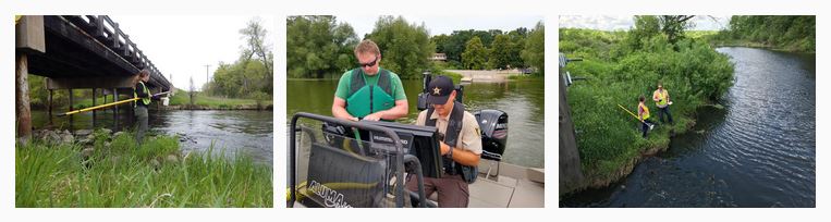
The purpose of the Subwatershed Assessment (SWA) Program is to improve water quality, increase groundwater recharge and reduce stormwater volumes in Sherburne County by identifying and prioritizing locations and retrofit projects that will yield the most cost effective results. The SWCD has completed numerous SWA studies: monitoring
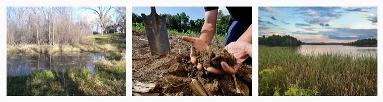
wetlands and the Wetland conservation act
Wetlands are transitional areas between upland and aquatic environments. They do not need to have standing water or cattails to qualify as a wetland. In Minnesota, an estimated 11 million acres of wetland areas have been lost in the last 100 years. There are approximately 9 million acres remaining. The Wetland Conservation Act (WCA) was passed in 1991. The goal of the act is to maintain and protect Minnesota’s wetlands and the benefits they provide.
Wetlands are actually regulated by the State of Minnesota as well as the federal government, not at the county level. The WCA is consistent in scope across the entire state. All decisions are based on the Wetland Conservation Act Rules, Chapter 8420. The Minnesota Board of Water and Soil Resources (BWSR) administer the WCA on a statewide basis, the Sherburne Soil and Water Conservation District (SWCD) implements the WCA locally. Wetlands are delineated according to the 1987 US Army Corps of Engineers Wetland Delineation Manual. Three conditions, or parameters are considered during wetland delineations:
Diagnostic / Feasibility Reports
The SWCD works with partners and contractors to study technical elements of natural resource concerns, including contracting with certified engineers to develop models or create highly technical BMP designs. Below are several recently completed diagnostic / feasibility studies: |
|


Sherburne Soil and Water Conservation District
Sherburneswcd.org 763-220-3434 425 Jackson Ave. NW Elk River, MN 55330
Open Monday - Friday 8:00 - 4:00, by appointment Closed on Federal Holidays
Sherburneswcd.org 763-220-3434 425 Jackson Ave. NW Elk River, MN 55330
Open Monday - Friday 8:00 - 4:00, by appointment Closed on Federal Holidays